Use APKPure App
Get Guthook's Pacific Crest Trail Guide old version APK for Android
오프라인으로 작동하는 퍼시픽 크레스트 트레일에 대한 상세한지도 기반 하이킹 가이드입니다.
Please download "Guthook Guides: Hike & Bike Offline" to access the Pacific Crest Trail guide. Existing customers may transfer their purchases to the Guthook Guides: Hike & Bike Offline app.
Guthook's Guide to the Pacific Crest Trail is a detailed, map-based 5-part smartphone guide for your hike on the Pacific Crest National Scenic Trail. It maps and lists 4,524 important hiker waypoints such as water sources, tenting sites, road crossings, detailed resupply information, and many more.
The free demo for the Pacific Crest Trail covers the 43 mile portion in Southern California from the U.S./Mexico Border to Mt. Laguna.
In-app purchases include guides for:
- PCT: Southern California
- PCT: Central California (Sierra)
- PCT: Northern California
- PCT: Oregon
- PCT: Washington
- John Muir Trail
- Mount Whitney Trail
- Wonderland Trail
Key features:
- No mobile or internet connection is required after initial setup -- works in Airplane Mode
- Detailed maps with your GPS location
- Elevation profile view
- Custom route creator
- Multiple offline map choices
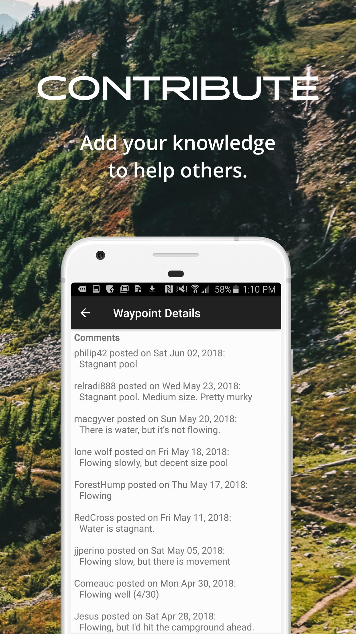
- Real-time comments from other hikers
- Send your current location to friends or family via text message or email
The guidebook lists every waypoint in order by distance along the trail and how far away you are from each waypoint. The guidebook also includes a detailed town guide for major resupply points, towns, and services along the PCT.
Waypoint details include:
- Mileage point and elevation
- Photographs
- Distance to the next water source and tent site
- Comments section where you may post comments and read other hikers’ comments
Types of waypoints:
- Water sources (including the reliability of each water source)
- Detailed resupply and town information:
- post offices and other package services
- restaurants
- grocery stores and convenience stores
- gear shops and hardware stores
- laundromats
- lodging, public showers, public restrooms
- public libraries
- Tenting sites/camping sites
- Trail junctions
- Parking areas along the trail
- Picnic areas, campgrounds, ranger stations
- Roads, railroad tracks, power lines, fences, gates
- Natural landmarks (e.g. mountain passes)
- Privies/restrooms
- Views
About the Pacific Crest Trail: The Pacific Crest Trail, or PCT, is the longest completed trail in the world at 2,650 miles. The trail begins at the U.S./Mexico border near Campo, California, and winds its way through California, Oregon, and Washington to its northern terminus at the U.S./Canada border near Manning Park in British Columbia, Canada. Many hikers complete the entire trail in just one season ( a.k.a. "thru-hikers"), and countless others enjoy hiking anywhere from a few miles to hundreds of miles each year.
Last updated on Oct 20, 2021
Improved functionality to migrate to consolidated app.
This app will be removed from the Play Store on January 1, 2022.


Discover what you want easier, faster and safer.

Guthook's Pacific Crest Trail Guide
8.3.8 by AtlasGuides
Oct 20, 2021